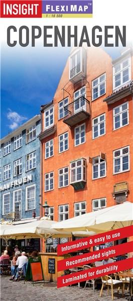
Insight Flexi Map: Copenhagen | Insight Guide

Detalii Insight Flexi Map: Copenhagen |
carturesti.ro
29 Lei
Carte straina
Insight Editions
Insight Flexi Map: Copenhagen | - Disponibil la carturesti.ro
Pe YEO găsești Insight Flexi Map: Copenhagen | de la Insight Editions, în categoria Carte straina.
Indiferent de nevoile tale, Insight Flexi Map: Copenhagen | Insight Guide din categoria Carte straina îți poate aduce un echilibru perfect între calitate și preț, cu avantaje practice și moderne.
Caracteristici și Avantaje ale produsului Insight Flexi Map: Copenhagen |
- Departament: gaming-carti-birotica
- Ideal pentru pasionații de jocuri, birotică și distracție online.
Preț: 29 Lei
Caracteristicile produsului Insight Flexi Map: Copenhagen |
- Brand: Insight Editions
- Categoria: Carte straina
- Magazin: carturesti.ro
- Ultima actualizare: 27-10-2025 01:24:43
Comandă Insight Flexi Map: Copenhagen | Online, Simplu și Rapid
Prin intermediul platformei YEO, poți comanda Insight Flexi Map: Copenhagen | de la carturesti.ro rapid și în siguranță. Bucură-te de o experiență de cumpărături online optimizată și descoperă cele mai bune oferte actualizate constant.
Descriere magazin:
Flexi Map Copenhagen is a laminated, tear-resistant map which has 3 maps, each accompanied by its own index. It includes a list - with descriptions and some photographs - of 23 recommended sights, divided by theme and linked to the mapping by numbered markers. There is also a handy information section with concise details on getting around, tourist offices, money, tipping, opening times, public holidays, telecommunications, emergency telephone numbers and climate. On the main map, shown at a scale of 1:12,500 (1cm = 0.125km), streets are named and a selection of hotels, public buildings and key sights are prominently marked, pedestrian areas and one-way systems are also shown. The comprehensive index is divided into categories for ease of use. A detailed Metro plan is located on the back cover for easy reference. A Copenhagen area map can be found on the reverse and shows the various routes into the city by road and rail. Also included is a map of the wider area, shown at a scale of 1:300,000 (1cm =3km). In addition to the road and rail networks, it provides a picture of the region\'s topography through the use of relief shading. Intermediate distance indicators are given on the main routes.

Produse asemănătoare
Produse marca Insight Editions

Star Wars: The Ultimate Cookbook: The Official Guide to Cooking Your Way Through the Galaxy - Insight Editions
![]() libris.ro
libris.ro
Actualizat in 28/10/2025
223.15 Lei

The Official Netflix Cookbook: 70 Recipes from Your TV to Your Table - Insight Editions
![]() libris.ro
libris.ro
Actualizat in 28/10/2025
195.25 Lei

Jim Henson\'s Labyrinth: Goodnight, Goblin King: (Bedtime Book) - Insight Editions
![]() libris.ro
libris.ro
Actualizat in 28/10/2025
105.97 Lei

Harry Potter: An Official Hogwarts Coloring Book - Insight Editions
![]() libris.ro
libris.ro
Actualizat in 28/10/2025
72.49 Lei

Star Wars: The Concept Art of Ralph McQuarrie Mini Book - Insight Editions
![]() libris.ro
libris.ro
Actualizat in 28/10/2025
72.49 Lei

Harry Potter: Travels Through the Wizarding World: An Official Coloring Book - Insight Editions
![]() libris.ro
libris.ro
Actualizat in 28/10/2025
72.49 Lei